| INTRODUCTION:
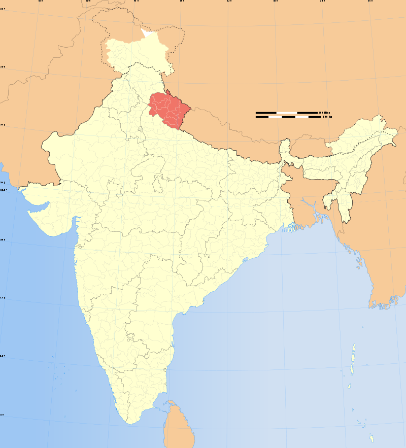
Uttarakhand formerly Uttaranchal, is a state in the northern part of India. It is often referred to as the Devbhumi (literally “Land of the Gods”) due to the many Hindu temples and pilgrimage centres found throughout the state. Uttarakhand is known for its natural beauty of the Himalayas, the Bhabar and the Terai. On 9 November 2000, this 27th state of the Republic of India was created from the Himalayan and adjoining northwestern districts of Uttar Pradesh. It borders Tibet on the north; the Mahakali Zone of the Far-Western Region, Nepal on the east; and the Indian states of Uttar Pradesh to the south and Himachal Pradesh to the west and Northwest as well as Haryana in the south western corner. The state is divided into two divisions, Garhwal and Kumaon, with a total of 13 districts. The interim capital of Uttarakhand is Dehradun, the largest city in the region, which is a railhead. The High Court of the state is in Nainital. |
 |
| GEOGRAPHY:
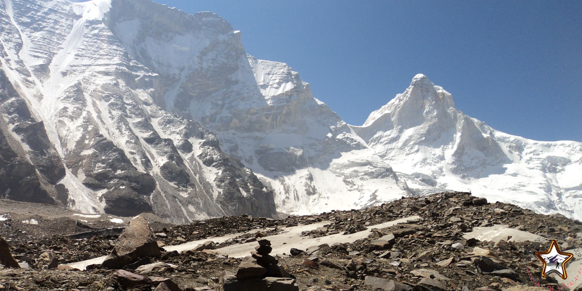
Uttarakhand has a total area of 53,483 km2, of which 86% is mountainous and 65% is covered by forest. Most of the northern part of the state is covered by high Himalayan peaks and glaciers. In the first half of the nineteenth century, the expanding development of Indian roads, railways and other physical infrastructure was giving rise to concerns over indiscriminate logging, particularly in the Himalaya. Two of the most important rivers in Hinduism originate in the region, the Ganges at Gangotri and the Yamuna at Yamunotri. These two along with Badrinath and Kedarnath form the Chota Char Dham, a holy pilgrimage for the Hindus. The state hosts the Bengal tiger in Jim Corbett National Park, the oldest national park of the Indian subcontinent. The Valley of Flowers, a UNESCO World Heritage Site located in the upper expanses of Bhyundar Ganga near Joshimath in Gharwal region, is known for the variety and rarity of its flowers and plants. One who raised this was Sir Joseph Dalton Hooker, Director of the Royal Botanic Gardens, Kew, who visited the region. As a consequence, Lord Dalhousie issued the Indian Forest Charter in 1855, reversing the previous laissez-faire policy. The following Indian Forest Act of 1878 put Indian forestry on a solid scientific basis. A direct consequence was the founding of the Imperial Forest School at Dehradun by Dietrich Brandis in 1878. Renamed the ‘Imperial Forest Research Institute’ in 1906, it is now known as the Forest Research Institute (India). The model “Forest Circles” around Dehradun, used for training, demonstration and scientific measurements, had a lasting positive influence on the forests and ecology of the region. The Himalayan ecosystem provides habitat for many animals (including bharal, snow leopards,leopards and tigers), plants, and rare herbs. Two of India’s largest rivers, the Ganges and the Yamuna, originate in the glaciers of Uttarakhand, where they are fed by myriad lakes, glacial melts and streams. Uttarakhand lies on the southern slope of the Himalaya range, and the climate and vegetation vary greatly with elevation, from glaciers at the highest elevations to subtropical forests at the lower elevations. The highest elevations are covered by ice and bare rock. Below them, between 3,000 and 5,000 metres (9,800 and 16,400 ft) are the western Himalayan alpine shrub and meadows. The temperate western Himalayan subalpine conifer forests grow just below the tree line. At 3,000 to 2,600 metres (9,800 to 8,500 ft) elevation they transition to the temperate western Himalayan broadleaf forests, which lie in a belt from 2,600 to 1,500 metres (8,500 to 4,900 ft) elevation. Below 1,500 metres (4,900 ft) elevation lie the Himalayan subtropical pine forests. The Upper Gangetic Plains moist deciduous forests and the drierTerai-Duar savanna and grasslands cover the lowlands along the Uttar Pradesh border in a belt locally known as Bhabar. These lowland forests have mostly been cleared for agriculture, but a few pockets remain. |
 |
| CLIMATE:
Due to extreme variation in elevation, great variation occurs in the climatic conditions of Himachal . The climate varies from hot and subhumid tropical in the southern tracts to, with more elevation, cold, alpine, and glacial in the northern and eastern mountain ranges. The state has areas like Dharamsala that receive very heavy rainfall, as well as those like Lahaul and Spiti that are cold and almost rainless. Broadly, Himachal experiences three seasons: summer, winter, and rainy season. Summer lasts from mid-April till the end of June and most parts become very hot (except in the alpine zone which experiences a mild summer) with the average temperature ranging from 28 to 32 °C (82 to 90 °F). Winter lasts from late November till mid March. Snowfall is common in alpine tracts (generally above 2,200 metres (7,218 ft) i.e. in the higher and trans-Himalayan region). |
|
CULTURE:Uttarakhand’s diverse ethnicities have created a rich literary tradition in languages including Hindi, Kumaoni, Garhwali, Jaunsari, and Bhoti. Many of its traditional tales originated in the form of lyrical ballads and chanted by itinerant singers and are now considered classics of Hindi literature. Ganga Prasad Vimal, Manohar Shyam Joshi, Prasoon Joshi, Shekhar Joshi, Shailesh Matiyani, Shivani, Sangeet Natak Akademi Awardee Mohan Upreti, B. M. Shah, Sahitya Akademi awardee Manglesh Dabral and Jnanpith awardee Sumitranandan Pant are some major literary figures from the region. Prominent philosopher and environmental activist Sundarlal Bahuguna and Vandana Shiva are also from Uttarakhand. The dances of the region are connected to life and human existence and exhibit myriad human emotions. Langvir Nritya is a dance form for males that resembles gymnastic movements. Barada Nati folk dance is another famous dance of Dehradun, which is practised during some religious festivals. Other well-known dances include Hurka Baul, Jhora-Chanchri, Jhumaila, Chauphula, and Chholiya. Music is an integral part of the Uttarakhandi culture. Popular types of folk songs include Mangal, Basanti, Khuded and Chhopati. These folk songs are played on instruments including dhol, damau, turri, ransingha, dholki, daur, thali, bhankora, mandan and mashakbaja. “Bedu Pako” is a populor folk song of Uttarakhand with international fame and legendary status within the state. It serves as unofficial state song of Uttarakhand. Music is also used as a medium through which the gods are invoked. Jagar is a form of spirit worship in which the singer, or Jagariya, sings a ballad of the gods, with allusions to great epics, like Mahabharat and Ramayana, that describe the adventures and exploits of the god being invoked. Narendra Singh Negi and Mina Rana are popular folk singers of the region. Among the prominent local crafts is wood carving, which appears most frequently in the ornately decorated temples of Uttarakhand. Intricately carved designs of floral patterns, deities, and geometrical motifs also decorate the doors, windows, ceilings, and walls of village houses. Beautifully worked paintings and murals are used to decorate both homes and temples. Pahari painting is a form of painting that flourished in the region between the 17th and 19th century. Mola Ram started the Garhwal Branch of the Kangra school of painting. Guler State was famous as the cradle of Kangra paintings. Kumaoni art often is geometrical in nature, while Garhwali art is known for its closeness to nature. Other crafts of Uttarakhand include handcrafted gold jewellery, basketry from Garhwal, woollen shawls, scarves, and rugs. The latter are mainly produced by the Bhotiyas of northern Uttarakhand.
The primary food of Uttarakhand is vegetables with wheat being a staple, although non-vegetarian food is also served. A distinctive characteristic of Uttarakhand cuisine is the sparing use of tomatoes, milk, and milk based products. Coarse grain with high fibre content is very common in Uttarakhand due to the harsh terrain. Another crop which is associated with Uttarakhand is Buckwheat (locally called Madua or Jhingora), particularly in the interior regions of Kumaon and Garhwal. Generally, either Desi Ghee or Mustard oil is used for the purpose of cooking food. Simple recipes are made interesting with the use of hash seeds “Jakhiya” as spice. Bal Mithai is a popular fudge-like sweet. Other popular dishes include Dubuk, Chains, Kap, Chutkani, Sei, and Gulgula. A regional variation of Kadhi called Jhoi or Jholi is also popular. One of the major Hindu pilgrimages, Haridwar Kumbh Mela, takes place in Uttarakhand. Haridwar is one of the four places in India where this mela is organised. Haridwar most recently hosted the Purna Kumbh Mela from Makar Sankranti (14 January 2010) to Vaishakh Purnima Snan (28 April 2010). Hundreds of foreigners joined Indian pilgrims in the festival which is considered the largest religious gathering in the world. Kumauni Holi, in forms including Baithki Holi, Khari Holi and Mahila Holi, all of which start from Vasant Panchami, are festivals and musical affairs that can last almost a month. Ganga Dashahara, Vasant Panchami, Makar Sankranti, Ghee Sankranti, Khatarua, Vat Savitri, and Phul Dei are other major festivals. In addition, various fairs like Kanwar Yatra, Kandali Festival, Ramman, Harela mela, Nauchandi mela, Uttarayani mela and Nanda Devi Raj Jat Mela take place. |
|
TRANSPORTATION:
|
|