| INTRODUCTION:
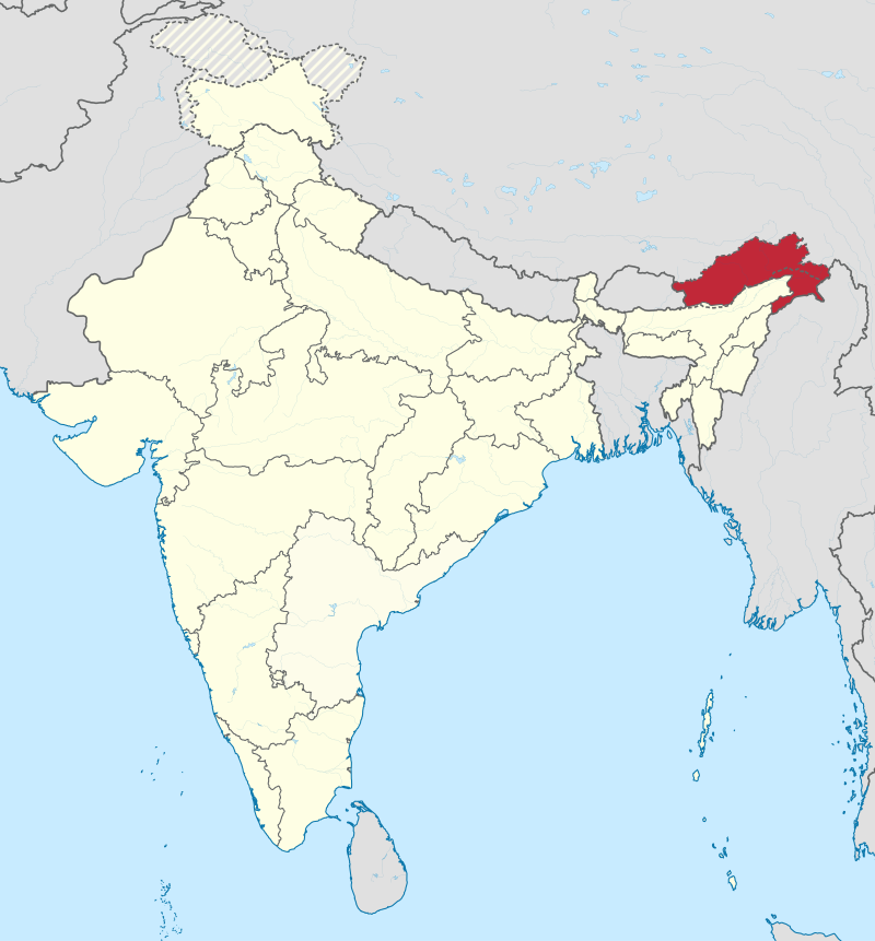
Arunachal Pradesh is one of the twenty-nine states of the Republic of India. Located in northeast India, it holds the most north-eastern position among the states in the north-east region of India. Arunachal Pradesh borders the states of Assam and Nagaland to the south, and shares international borders with Bhutan in the west, Burma in the east and China in the north. Itanagar is the capital of the state. Most of the state, formerly called the North-East Frontier Agency, was ceded to Britain by the Tibetan government with the Simla Accord (1914). China does not recognize the legality of that treaty, and claims most of the state as South Tibet. The state is seen to have major potential for hydropower development. Arunachal Pradesh whose name means Land of the Dawn-Lit Mountains in Sanskrit, is also known as the Orchid State of India or the Paradise of the Botanists. Geographically, it is the largest among the North-east Indian states commonly known as the Seven Sister States. As in other parts of Northeast India, the people native to the state trace their origins to the Tibeto-Burman people. In recent times, large number of migrants from various parts of India and other lands have built extensive economic and cultural ties with the state’s population. No reliable population count of the migrant population exists, and the percentage estimating the total actual population accordingly, vary. Arunachal Pradesh has the highest number of regional languages in the Indian subcontinent, enriched with diverse culture and traditions.
|
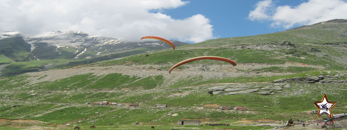 |
| GEOGRAPHY:
Arunachal Pradesh is located between 26.28° N and 29.30° N latitude and 91.20° E and 97.30° E longitude and has 83,743 square kilometre area. Most of Arunachal Pradesh is covered by the Himalayas. However, parts of Lohit, Changlang and Tirap are covered by the Patkai hills. Kangto, Nyegi Kangsang, the main Gorichen peak and the Eastern Gorichen peak are some of the highest peaks in this region of the Himalayas. The land is mostly mountainous with the Himalayan ranges running north south. These divide the state into five river valleys: the Kameng, the Subansiri, the Siang, the Lohit and the Tirap. All these are fed by snow from the Himalayas and countless rivers and rivulets. The mightiest of these rivers is Siang, called the Tsangpo in Tibet, which becomes the Brahmaputra after it is joined by the Dibang and the Lohit in the plains of Assam. At the lowest elevations, essentially at Arunachal Pradesh’s border with Assam, are Brahmaputra Valley semi-evergreen forests. Much of the state, including the Himalayan foothills and the Patkai hills, are home to Eastern Himalayan broadleaf forests. Toward the northern border with Tibet, with increasing elevation, come a mixture of Eastern and Northeastern Himalayan subalpine conifer forests followed by Eastern Himalayan alpine shrub and meadows and ultimately rock and ice on the highest peaks. The Himalayan ranges that extend up to the eastern Arunachal separate it from Tibet. The ranges extend toward Nagaland, and form a boundary between India and Burma in Changlang and Tirap district, acting as a natural barrier called Patkai Bum Hills. They are low mountains compared to the Greater Himalayas. |
 |
| CLIMATE:
Due to extreme variation in elevation, great variation occurs in the climatic conditions of Himachal . The climate varies from hot and subhumid tropical in the southern tracts to, with more elevation, cold, alpine, and glacial in the northern and eastern mountain ranges. The state has areas like Dharamsala that receive very heavy rainfall, as well as those like Lahaul and Spiti that are cold and almost rainless. Broadly, Himachal experiences three seasons: summer, winter, and rainy season. Summer lasts from mid-April till the end of June and most parts become very hot (except in the alpine zone which experiences a mild summer) with the average temperature ranging from 28 to 32 °C (82 to 90 °F). Winter lasts from late November till mid March. Snowfall is common in alpine tracts (generally above 2,200 metres (7,218 ft) i.e. in the higher and trans-Himalayan region). |
|
CULTURE:Arunachal Pradesh can be roughly divided into a set of semi-distinct cultural spheres, on the basis of tribal identity, language, religion and material culture: the Tibetic area bordering Bhutan in the west, the Thanyi area in the centre of the state, the Mishmi area to the east of the Thanyi area, the Tai/Singpho/Tangsa area bordering Myanmar, and the “Naga” area to the south, which also borders Myanmar. In between there are transition zones, such as the Aka/Hruso/Miji/Sherdukpen area, which provides a “buffer” of sorts between the Tibetic Buddhist tribes and the animist Thanyi hill tribes. In addition, there are isolated peoples scattered throughout the state, such as the Sulung. Within each of these cultural spheres, one finds populations of related tribes speaking related languages and sharing similar traditions. In the Tibetic area, one finds large numbers of Monpa tribespeople, with several subtribes speaking closely related but mutually incomprehensible languages, and also large numbers of Tibetan refugees. Within the Thanyi area, major tribes include the Nyishi, which many people have recently come to apply to encompass the derogatory words; like dafla & Hills Miri. Apatani also live among the Nyishi, but are distinct. In the centre, one finds predominantly Galo people, with the major sub-groups of Karka, Lodu, Bogum, Lare and Pugo among others, extending to the Ramo and Pailibo areas (which are close in many ways to Galo). In the east, one finds the Adi with many subtribes including Padam, Pasi, Minyong and Bokar, among others. Milang, while also falling within the general “Adi” sphere, are in many ways quite distinct. Moving east, the Idu, Miju and Digaru make up the “Mishmi” cultural-linguistic area, which may or may not form a coherent historical grouping. Moving southeast, the Tai Khamti are linguistically distinct from their neighbours and culturally distinct from the majority of other Arunachalese tribes. They follow the Theravada∞ sect of Buddhism. They also exhibit considerable convergence with the Singpho and Tangsa tribes of the same area, all of which are also found in Burma. Besides, the Nocte and Wancho exhibit cultural and possibly also linguistic affinities to the tribes of Nagaland, which they border. Finally, the Deori tribe is also a major community of the state, with their own distinctive identity. The Deoris are one of the only Arunachal Pradesh tribes in the historical records—which shows they are among the first ethnic groups to inhabit the Himalayas of the districts of Dibang Valley and Lohit, before the arrival of other many tribes in the state between 1600 and 1900. The ruins of the town of Bhismaknagar and Taameshwari temple are documented by ASI to give a light about the history of Deori people. |
|
TRANSPORTATION:
Air
|
|