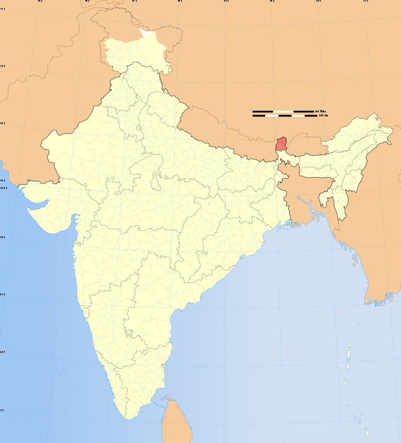
| INTRODUCTION: Sikkim is a landlocked Indian state located in the Himalayan mountains. The state is bordered by Nepal to the west, China’s Tibet Autonomous Region to the north and east, and Bhutan to the east. The Indian state of West Bengal lies to the south. With 607,688 inhabitants as of the 2011 census, Sikkim is the least populous state in India and the second-smallest state after Goa in total area, covering approximately 7,096 km2 (2,740 sq mi). Sikkim is nonetheless geographically diverse due to its location in the Himalayas; the climate ranges from subtropical to high alpine, and Kangchenjunga, the world’s third-highest peak, is located on Sikkim’s border with Nepal. Sikkim is a popular tourist destination, owing to its culture, scenery and biodiversity. It also has the only open land border between India and China. Sikkim’s capital and largest city is Gangtok. Almost 25% of the state is covered by the Khangchendzonga National Park.According to legend, the Buddhist guru Padmasambhava visited Sikkim in the 8th century CE, introduced Buddhism and foretold the era of the Sikkimese monarchy. Sikkim’s Namgyal dynasty was established in 1642. Over the next 150 years, the kingdom witnessed frequent raids and territorial losses to Nepalese invaders. In the 19th century, it allied itself with British India, eventually becoming a Britishprotectorate.In 1975, a referendum abolished the Sikkimese monarchy, and the territory instead became part of India. | 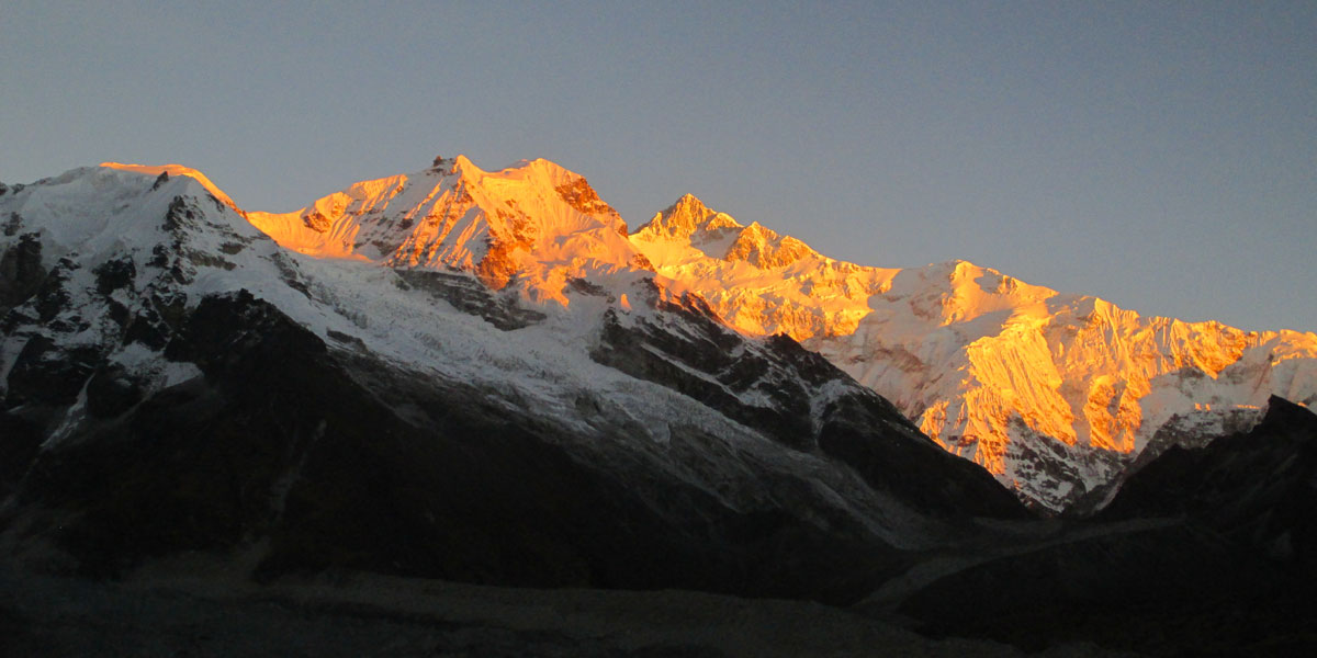 |
| GEOGRAPHY: Nestling in the Himalayan mountains, the state of Sikkim is characterised by mountainous terrain. Almost the entire state is hilly, with an elevation ranging from 280 metres (920 ft) to 8,586 metres (28,169 ft). The summit of Kangchenjunga—the world’s third-highest peak—is the state’s highest point, situated on the border between Sikkim and Nepal. For the most part, the land is unfit for agriculture because of the rocky, precipitous slopes. However, some hill slopes have been converted into terrace farms. Numerous snow-fed streams have carved out river valleys in the west and south of the state. These streams combine into the major Teesta River and its tributary, the Rangeet, which flow through the state from north to south. About a third of the state is heavily forested.
Sunrise on Kangchenjungha as seen from Pelling in West Sikkim The Himalayan mountains surround the northern, eastern and western borders of Sikkim. The Lower Himalayas, lying in the southern reaches of the state, are the densely populated. The state has 28 mountain peaks, more than 80 glaciers, 227 high-altitude lakes (including the Tsongmo, Gurudongmar and Khecheopalri Lakes), five major hot springs, and more than 100 rivers and streams. Eight mountain passes connect the state to Tibet, Bhutan and Nepal. Khecheopalri Lake, considered holy by Buddhists (both Bhutias and Lepchas) in West Sikkim. Sikkim’s hot springs are renowned for their medicinal and therapeutic values. Among the state’s most notable hot springs are those at Phurchachu, Yumthang, Borang, Ralang, Taram-chu and Yumey Samdong. The springs, which have a high sulphur content, are located near river banks; some are known to emit hydrogen. The average temperature of the water in these hot springs is 50 °C (122 °F). |
 |
| CLIMATE: The state has five seasons: winter, summer, spring, autumn, and a monsoon season between June and September. Sikkim’s climate ranges from sub-tropical in the south to tundra in the north. Most of the inhabited regions of Sikkim experience a temperate climate, with temperatures seldom exceeding 28 °C (82 °F) in summer. The average annual temperature for most of Sikkim is around 18 °C (64 °F). Sikkim is one of the few states in India to receive regular snowfall. The snow line ranges from 6,100 metres (20,000 ft) in the south of the state to 4,900 metres (16,100 ft) in the north. The tundra-type region in the north is snowbound for four months every year, and the temperature drops below 0 °C (32 °F) almost every night. In north-western Sikkim, the peaks are frozen year-round; because of the high altitude, temperatures in the mountains can drop to as low as −40 °C (−40 °F) in winter. | |
|
CULTURE: Sikkim’s Nepalese majority celebrate all major Hindu festivals, including Diwali and Dussera. Traditional local festivals, such as Maghe Sankranti and Bhimsen Puja, are also popular. Losar, Loosong, Saga Dawa, Lhabab Duechen, Drupka Teshi and Bhumchu are among the Buddhist festivals celebrated in Sikkim. During the Losar (Tibetan New Year), most offices and educational institutions are closed for a week. Sikkimese Muslims celebrate Eid ul-Fitr and Muharram. Christmas has also been promoted in Gangtok to attract tourists during the off-season. Western rock music and Indian pop have gained a wide following in Sikkim. Indigenous Nepali rock and Lepcha music are also popular. Sikkim’s most popular sports are football and cricket, although hang gliding and river rafting have also grown popular as part of the tourism industry. |
|
TRANSPORTATION:
AirThe Teesta River is considered the state’s key waterway. Sikkim currently does not have any operational airports or rail heads because of its rough terrain. However, Pakyong Airport, the state’s first airport, located at a distance of 30 km (19 mi) from Gangtok, is expected to become operational in March 2016, after its completion was delayed from the original target of 2014. It is being constructed by the Airports Authority of India on 200 acres of land. At an altitude of 4,700 feet (1,400 m) above sea level, it will be one of the five highest airports in India. The airport will be capable of operating ATR aircraft. As of 2015, the closest operational airport to Sikkim is Bagdogra Airport, near the town of Siliguri in West Bengal. The airport is located about 124 km (77 mi) from Gangtok, and frequent buses connect the two. A daily helicopter service run by the Sikkim Helicopter Service connects Gangtok to Bagdogra; the flight is thirty minutes long, operates only once a day, and can carry four people. The Gangtok helipad is the only civilian helipad in the state. RoadsA mountain road through Temi Tea Garden. National Highway 31A and National Highway 31 link Siliguri to Gangtok. Sikkim National Transport runs bus and truck services. Privately run bus, tourist taxi and jeep services operate throughout Sikkim, and also connect it to Siliguri. A branch of the highway from Melli connects western Sikkim. Towns in southern and western Sikkim are connected to the hill stations of Kalimpong and Darjeeling in northern West Bengal. The state is furthermore connected to Tibet by the mountain pass of Nathu La. RailSikkim lacks significant railway infrastructure. The closest major railway stations are Siliguri and New Jalpaiguri in neighbouring West Bengal. However, the New Sikkim Railway Project has been launched to connect the town of Rangpo in Sikkim with Sevoke on the West Bengal border. The five-station line is intended to support both economic development and Indian Army operations, and was initially planned to be completed by 2015, though as of 2013 its construction has met with delays. In addition, the Ministry of Railways proposed plans in 2010 for railway lines linking Mirik to Ranipool.
|
|