| INTRODUCTION:
Ladakh (“land of high passes”) is a region in the Indian Occupied Jammu and Kashmir that currently extends from the Kuen Lun mountain range to the main Great Himalayas to the south, inhabited by people of Indo-Aryan and Tibetan descent. It is one of the most sparsely populated regions in Jammu and Kashmir and its culture and history are closely related to that of Tibet. Historically, the region included the Baltistan (Baltiyul) valleys (now mostly in Pakistan), the entire upper Indus Valley, the remote Zanskar, Lahaul and Spiti to the south, much of Ngari including the Rudok region and Guge in the east, Aksai Chin in the northeast (extending to the Kun Lun Mountains), and the Nubra Valley to the north over Khardong La in the Ladakh Range. Contemporary Ladakh borders Tibet to the east, the Lahaul and Spiti regions to the south, the Vale of Kashmir, Jammu and Baltiyul regions to the west, and the southwest corner of Xinjiang across the Karakoram Pass in the far north. Ladakh is renowned for its remote mountain beauty and culture. Aksai Chin is one of the disputed border areas between China and India. It is administered by China as part of Hotan County but is also claimed by India as a part of the Ladakh region of the state of Jammu and Kashmir. In 1962, China and India fought a brief war over Aksai Chin and Arunachal Pradesh, but in 1993 and 1996 the two countries signed agreements to respect the Line of Actual Control. In the past Ladakh gained importance from its strategic location at the crossroads of important trade routes, but since the Chinese authorities closed the borders with Tibet and Central Asia in the 1960s, international trade has dwindled except for tourism. Since 1974, the Government of India has successfully encouraged tourism in Ladakh. Since Ladakh is a part of strategically important Jammu and Kashmir, the Indian military maintains a strong presence in the region. The largest town in Ladakh is Leh followed by Kargil. Almost half of Ladakhis are Shia Muslims and the rest are mostly Tibetan Buddhists. Some Ladakhi activists have in recent times called for Ladakh to be constituted as a union territory because of perceived unfair treatment by Kashmir and Ladakh’s cultural differences with predominantly Muslim Kashmir. |
 |
| GEOGRAPHY:
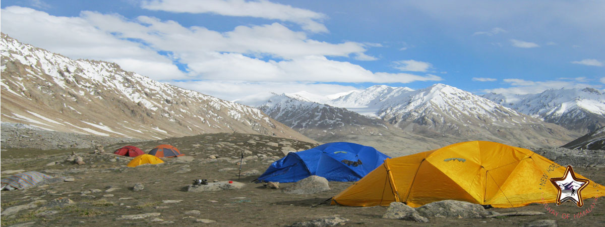
Ladakh is the highest plateau of state of Kashmir with much of it being over 3,000 m (9,800 ft). It extends from the Himalayan to the Kunlun Ranges and includes the upper Indus River valley. Contemporary Ladakh borders Tibet to the east, the Lahaul and Spiti regions to the south, the Vale of Kashmir, Jammu and Baltiyul regions to the west, and the southwest corner of Xinjiang across the Karakoram Pass in the far north. The historic but imprecise divide between Ladakh and the Tibetan Plateau commences in the north in the intricate maze of ridges east of Rudok including Aling Kangri and Mavang Kangri, and continues southeastward toward northwestern Nepal. Before partition, Baltistan, now under Pakistani control, was a district in Ladakh. Skardo was the winter capital of Ladakh while Leh was the summer capital. The mountain ranges in this region were formed over 45 million years by the folding of the Indian plate into the more stationary Eurasian Plate. The drift continues, causing frequent earthquakes in the Himalayan region. The peaks in the Ladakh Range are at a medium altitude close to the Zoji-la (5,000–5,500 m or 16,000–18,050 ft) and increase toward southeast, culminating in the twin summits of Nun-Kun (7000 m or 23,000 ft). The Suru and Zanskar valleys form a great trough enclosed by the Himalayas and the Zanskar Range. Rangdum is the highest inhabited region in the Suru valley, after which the valley rises to 4,400 m (14,400 ft) at Pensi-la, the gateway to Zanskar. Kargil, the only town in the Suru valley, is the second most important town in Ladakh. It was an important staging post on the routes of the trade caravans before 1947, being more or less equidistant, at about 230 kilometres from Srinagar, Leh, Skardu and Padum. The Zangskar valley lies in the troughs of the Stod and the Lungnak rivers. The region experiences heavy snowfall; the Pensi-la is open only between June and mid-October. Dras and the Mushkoh Valley form the western extremity of Ladakh. The Indus River is the backbone of Ladakh. Most major historical and current towns — Shey, Leh, Basgo and Tingmosgang (but not Kargil), are close to the Indus River. After the Indo-Pakistani War of 1947, the stretch of the Indus flowing through Ladakh became the only part of this river, which is greatly venerated in the Hindu religion and culture, that still flows through India. The Siachen Glacier is in the eastern Karakoram Range in the Himalaya Mountains along the disputed India-Pakistan border. The Karakoram Range forms a great watershed that separates China from the Indian subcontinent and is sometimes called the “Third Pole.” The glacier lies between the Saltoro Ridge immediately to the west and the main Karakoram Range to the east. At 76 km long, it is the longest glacier in the Karakoram and second-longest in the world’s non-polar areas. It falls from an altitude of 5,753 m (18,875 ft) above sea level at its source at Indira Col on the China border down to 3,620 m (11,880 ft) at its snout. Saser Kangri is the highest peak in the Saser Muztagh, the easternmost subrange of the Karakoram Range in India, Saser Kangri I having an altitude of 7,672 m (25,171 ft). |
 |
| CLIMATE:
The state has five seasons: winter, summer, spring, autumn, and a monsoon season between June and September. Sikkim’s climate ranges from sub-tropical in the south to tundra in the north. Most of the inhabited regions of Sikkim experience a temperate climate, with temperatures seldom exceeding 28 °C (82 °F) in summer. The average annual temperature for most of Sikkim is around 18 °C (64 °F). Sikkim is one of the few states in India to receive regular snowfall. The snow line ranges from 6,100 metres (20,000 ft) in the south of the state to 4,900 metres (16,100 ft) in the north. The tundra-type region in the north is snowbound for four months every year, and the temperature drops below 0 °C (32 °F) almost every night. In north-western Sikkim, the peaks are frozen year-round; because of the high altitude, temperatures in the mountains can drop to as low as −40 °C (−40 °F) in winter. |
|
CULTURE:Ladakhi culture is similar to Tibetan culture. Tibet developed a distinct culture due to its geographic and climatic conditions. While influenced by neighboring countries and cultures, including Nepal, India, and China, the Himalayan region’s remoteness and inaccessibility have preserved distinct local influences, and stimulated the development of its distinct culture. Buddhism has exerted a particularly strong influence on Tibetan culture since its introduction in the 7th century. Buddhist missionaries who came mainly from Nepal and China introduced arts and customs from India and China. Art, literature, and music all contain elements of the prevailing Buddhist beliefs, and Buddhism itself has adopted a unique form in Tibet, influenced by the Bon tradition and other local beliefs. Several works on astronomy, astrology and medicine were translated from Sanskrit and Chinese. The general appliances of civilization have come from China, among many things and skill imported were the making of butter, cheese, barley-beer, pottery, water mills and the national beverage-tea. |
|
| TRANSPORTATION:
There are about 1,800 km (1,100 mi) of roads in Ladakh of which 800 km (500 mi) are surfaced. The majority of roads in Ladakh are looked after by the Border Roads Organisation. Ladakh was the connection point between Central Asia and South Asia when the Silk Road was in use. The sixty-day journey on the Ladakh routeconnecting Amritsar and Yarkand through eleven passes was frequently undertaken by traders till the third quarter of the 19th century. Another common route in regular use was the Kalimpong route between Leh and Lhasa via Gartok, the administrative centre of western Tibet. Gartok could be reached either straight up the Indus in winter or through either the Taglang la or the Chang la. Beyond Gartok, the Cherko la brought travelers to the Manasarovar and Rakshastal lakes, and then to Barka, which is connected to the main Lhasa road. These traditional routes have been closed since the Ladakh-Tibet border was sealed by the Chinese government. Other routes connected Ladakh to Hunza and Chitral but, as in the previous case, there is no border crossing between Ladakh and Pakistan. In present times, the only two land routes to Ladakh in use are from Srinagar and Manali. Travelers from Srinagar start their journey from Sonamarg, over the Zoji La pass (3,450 m; 11,320 ft) via Dras and Kargil (2,750 m; 9,020 ft) passing through Namika la (3,700 m; 12,100 ft) and Fatu la (4,100 m; 13,500 ft). This has been the main traditional gateway to Ladakh since historical times and is now open to traffic from April or May until November or December every year. The newer route is the high altitude Manali-Leh Highway from Himachal Pradesh. The highway crosses four passes, Rohtang la (3,978 m; 13,051 ft), Baralacha la (4,892 m; 16,050 ft), Lungalacha la (5,059 m; 16,598 ft) and Taglang la(5,325 m; 17,470 ft) and the More plains and is open only between May and November when snow is cleared from the road. Buses run from Leh to the villages throughout the year. Ladakh is criss-crossed by a complex network of mountain trails which even today provides the only link to some of the valleys, villages and high pastures. Though much of the road network in Kargil has only recently been taken up with the help of funds mostly from the central Govt. Prior to that some major roads into various villages like Drass, Hardas, Kaksar and Sodh were constructed by the Indian Army partly for transportation of defence equipment and partly as goodwill gesture. There is one airport in Leh, from which there are daily flights to Delhi and weekly flights to Srinagar and Jammu. There are two airstrips at Daulat Beg Oldie and Fukche for military transport. While an airport meant for civilian purpose at Kargil is used by the Indian Army. The airport is a political issue for the locals who argue that the airport should serve its original purpose, i.e., should open up for civilian flights. Since past few years the Indian Air Force has been operating AN-32 air courier service to transport the locals during the winter seasons to Jammu, Srinagar and Chandigarh. A private airplane company Air Mantra landed a 17-seater aircraft at the airport, in presence of dignitaries like the Chief Minister Omar Abdullah, marking the first ever landing by a civilian airline company at Kargil. |
|
